Skip to search
Skip to main content
AGSL GeoDiscovery
AGSL GeoDiscovery
Search History
About
AGSL Home
Help
search for
Search
Search
Search
Advanced
AGSL GeoDiscovery
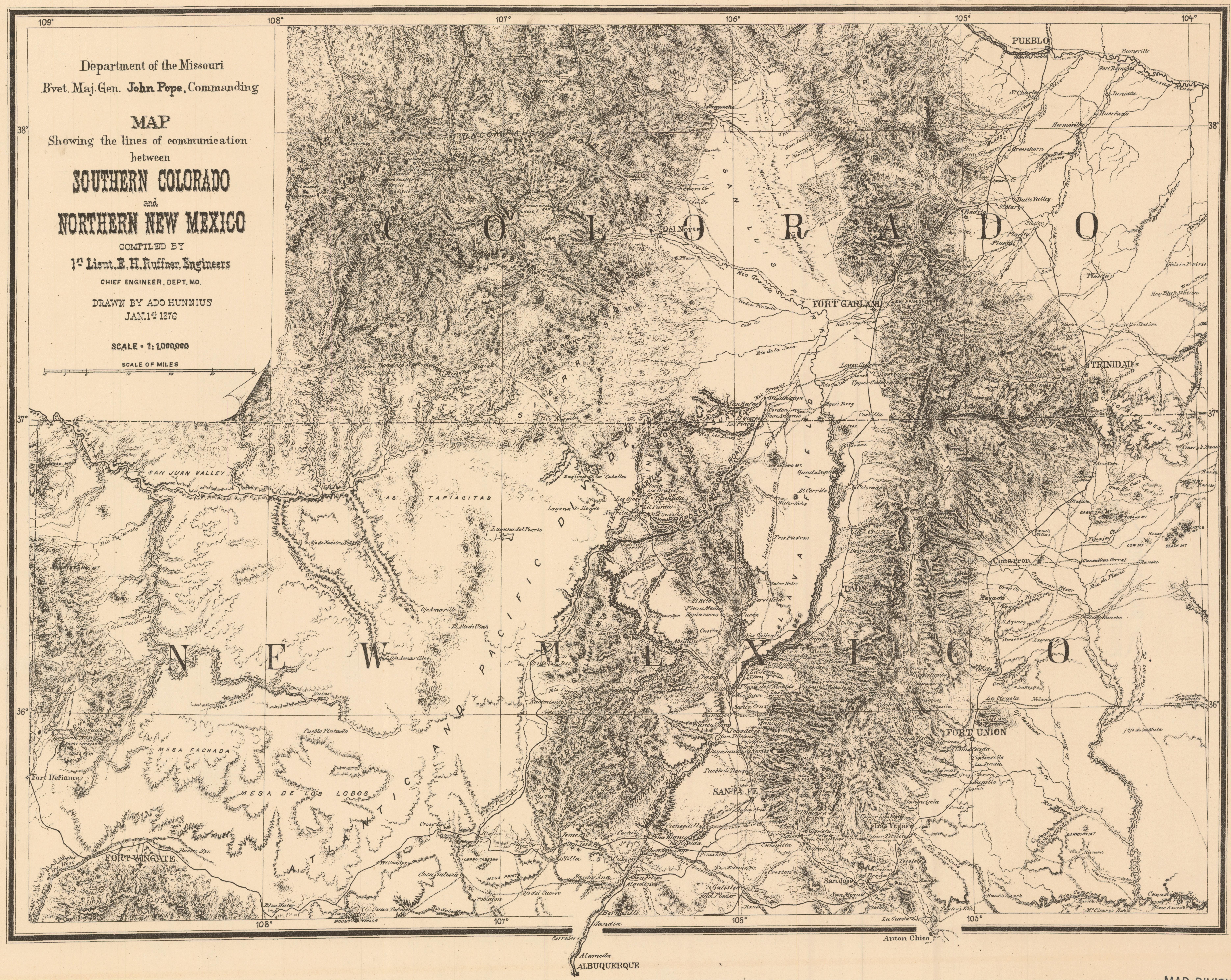
Map showing the lines of communication between Southern Colorado and Northern New Mexico
Maps
Princeton University
Public content
Georeferenced: false
Item Viewer
IIIF Service
Description:
Relief shown by hachures.
Resource Link:
https://catalog.princeton.edu/catalog/9968141603506421
Identifier:
ark:/88435/pk02cd185
Language:
en
and
English
Creator:
Ruffner, E. H. (Ernest Howard), 1845-1937
and
Ruffner, E. H. (Ernest Howard), b. 1845
Publisher:
[Washington, D.C.] : U.S. Army, Dept. of the Missouri, 1876.
Provider:
Princeton
Resource Class:
Maps
Resource Type:
Image
Subject:
Trails—Colorado—Maps
,
Trails—New Mexico—Maps
,
Colorado—Maps
,
New Mexico—Maps
,
Maps—Colorado—1876
,
Maps—New Mexico—1876
, and
Maps
Theme:
Trails—Colorado—Maps
,
Trails—New Mexico—Maps
,
Colorado—Maps
,
New Mexico—Maps
,
Maps—Colorado—1876
,
Maps—New Mexico—1876
, and
Maps
Spatial Coverage:
Colorado
and
New Mexico
Access Rights:
Public
Format:
TIFF
Tools
Cite
Email
Georeferencing
Loading...
Web services
Download
Original
Tiff
Original JPG