Skip to search
Skip to main content
AGSL GeoDiscovery
AGSL GeoDiscovery
Search History
About
AGSL Home
Help
search for
Search
Search
Search
Advanced
AGSL GeoDiscovery
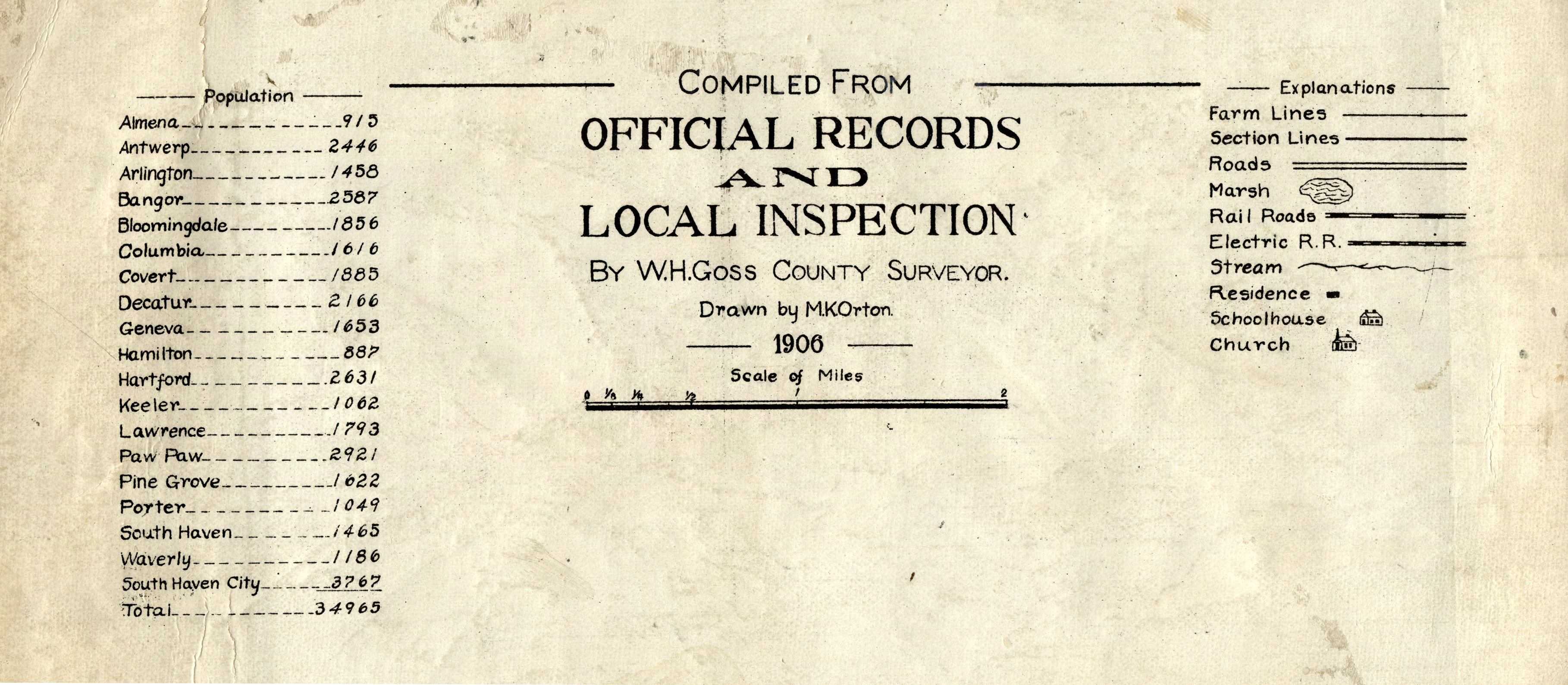
[Title page] Compiled from Official Records and Local Inspection
Datasets
Michigan State University
Public content
Georeferenced: false
Item Viewer
Resource Link:
https://lib.msu.edu/branches/map/MSU-Scanned/Michigan/4_g1413v3k3_1895_l/
Identifier:
bfa8f078-dec3-4071-b793-5ba85c77e2d1
Language:
eng
Creator:
Orton, M. K.
Provider:
Michigan State University
Resource Class:
Datasets
Temporal Coverage:
1906
Spatial Coverage:
Michigan--Van Buren County
Access Rights:
Public
Format:
JPEG
Tools
Cite
Email
Download
JPEG