Skip to search
Skip to main content
AGSL GeoDiscovery
AGSL GeoDiscovery
Search History
About
AGSL Home
Help
search for
Search
Search
Advanced
AGSL GeoDiscovery
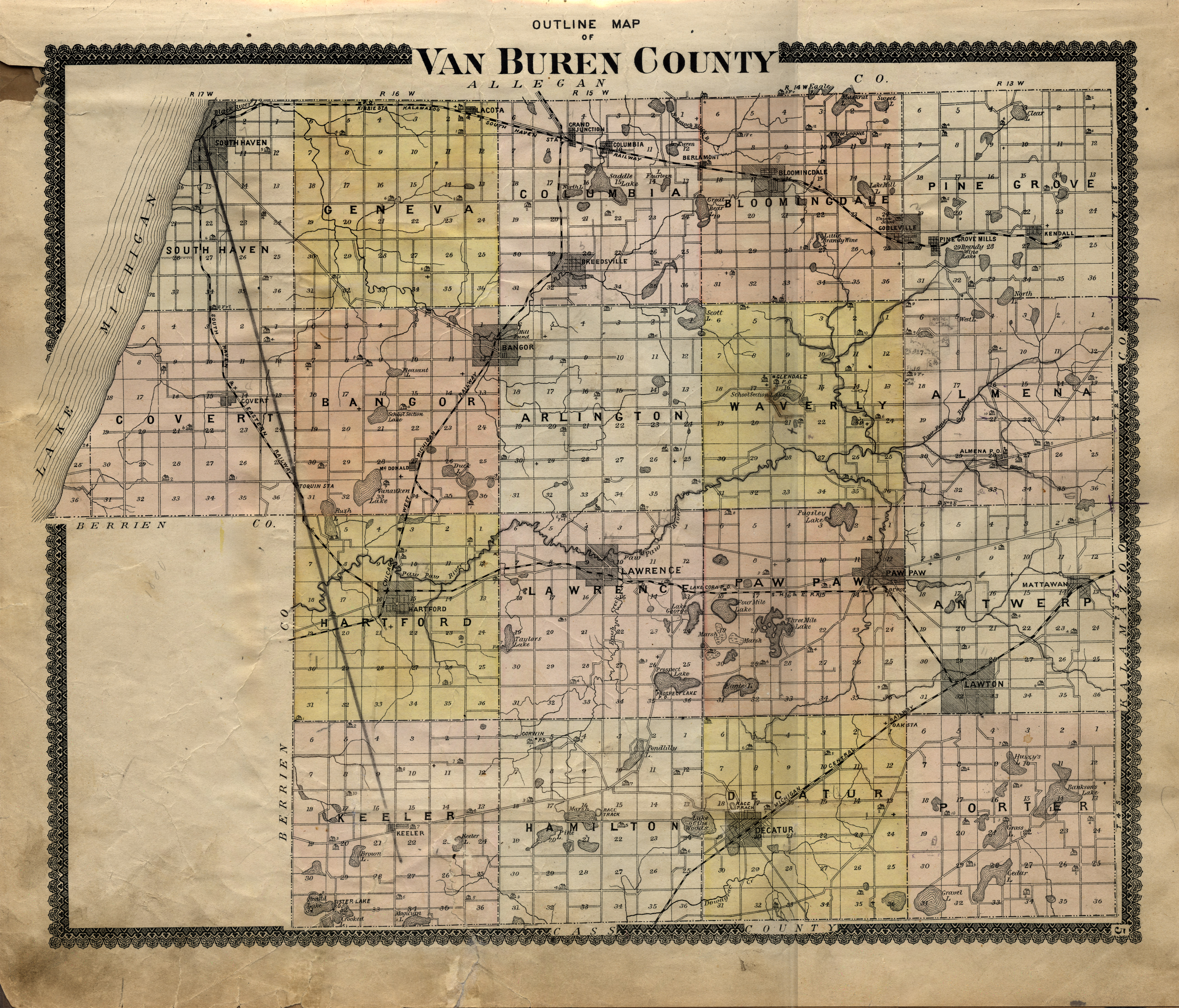
Outline Map of Van Buren County
Maps
Michigan State University
Public content
Georeferenced: false
Item Viewer
Resource Link:
https://lib.msu.edu/branches/map/MSU-Scanned/Michigan/5_g1413v3k3_1895_l/
Identifier:
252737ee-1346-4b01-9218-4efa035a1e77
Language:
eng
Creator:
Orton, M. K.
Provider:
Michigan State University
Resource Class:
Maps
Temporal Coverage:
1906
Spatial Coverage:
Michigan--Van Buren County
Access Rights:
Public
Format:
JPEG
Tools
Cite
Email
SMS This
Download
JPEG